Are you a disaster survivor looking for help? Click here
This Week in Disasters

Ross Fire. Source: Texas A&M Forest Service
A major hurricane is bearing down on Kauai, and no one can say what started the second-largest fire in North Texas history.
Welcome back to This Week in Disasters! This newsletter combines expert perspectives with a weekly roundup of upcoming threats, recent natural disasters, and available survivor assistance. If you're a Risk, Insurance, Employee Assistance, or Emergency Management professional (or you're just really curious about weather in the United States!) you're in the right place.
A note on the numbers below: the 2026 fire year has now burned more than 8.2 million acres, 161 percent of the 10-year average for this date, and the national preparedness level has sat at 5 since July 18.
Major Disasters of the Last Week
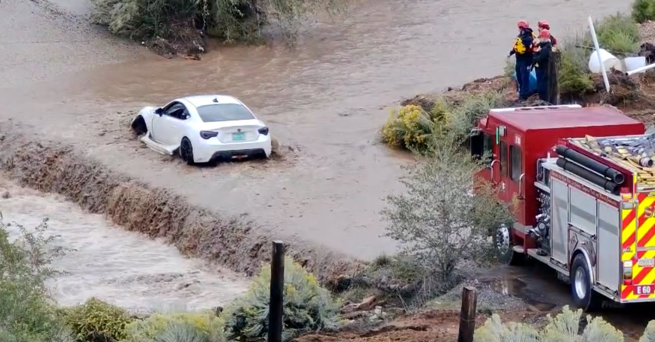
Tropical Storm Edouard Edouard came ashore near Johnson Bayou, Louisiana on September 1 with 60 mph sustained winds and 996 mb pressure, then stalled over Southeast Texas and dropped more than 20 inches of rain in Hardin and Tyler counties. Entergy Texas outages peaked near 80,000 customers and were more than 90 percent restored by Friday morning, with no deaths reported. Hardin, Polk and Jefferson counties declared local disasters; crews evacuated 21 residents from a damaged assisted living facility and pulled a dozen motorists and a family of five from floodwater. Read more. |
Grand Canyon Flash Flood Two hikers died and one man remains missing after an August 29 flash flood tore through Bright Angel Canyon and the Phantom Ranch area of Grand Canyon National Park, where 82 people were rescued including 62 by air. Park officials say roughly 40 percent of the Transcanyon Waterline was damaged or destroyed, leaving about 2,000 South Rim residents with two to three weeks of water supply. The park closed all South Rim overnight lodging effective August 31 and moved to Stage 4 water restrictions. Read more. |
Ross Fire, Texas The Ross Fire in Palo Pinto and Jack counties reached about 90,400 acres and 38 percent containment, making it the second-largest wildfire in recorded North Texas history. A completed damage survey put losses at 157 structures destroyed and 140 damaged, with no deaths or injuries. Texas A&M Forest Service now says the fire started along a road and was sparked by equipment or a vehicle, revising an earlier finding that pointed to a tire blowout. Read more. |
San Antonio Windstorm Straight-line winds with measured speeds of 50 to 65 mph and radar-estimated gusts near 80 mph moved across Bexar County the night of August 28, knocking out power to more than 100,000 CPS Energy customers and downing poles, lines and trees from the northeast side through southwest Bexar. The National Weather Service ruled out a tornado. On September 2, Governor Abbott directed TDEM to request that SBA join state and local officials for joint preliminary damage assessments in Bexar County. Read more. |
Seneca County, New York Tornadoes NWS Binghamton confirmed two tornadoes from storms the evening of September 2: an EF2 near Fayette with 115 mph peak winds on a roughly seven-mile path, the strongest tornado in New York so far this year, and an EF1 that ran six to seven miles from Waterloo through Seneca Falls with 95 mph winds. A mesonet station at Waterloo measured a 76 mph downburst gust between the two tracks. About 8,000 NYSEG customers lost power. Read more. |
Detroit Tornado and Michigan Outages The National Weather Service confirmed a tornado touched down on Detroit's east side the evening of September 3, with building collapses near Mount Elliott and East Vernor and damage running southeast toward Belle Isle. Outages across metro Detroit peaked between 250,000 and 264,000 customers, with about 242,000 DTE customers still out Friday morning and one person hospitalized after a tree fell on a home. The rating is still pending; NWS separately confirmed an EF-0 in Marysville, St. Clair County, from storms the night before. Read more. |
Forecasted Risks for Next Week
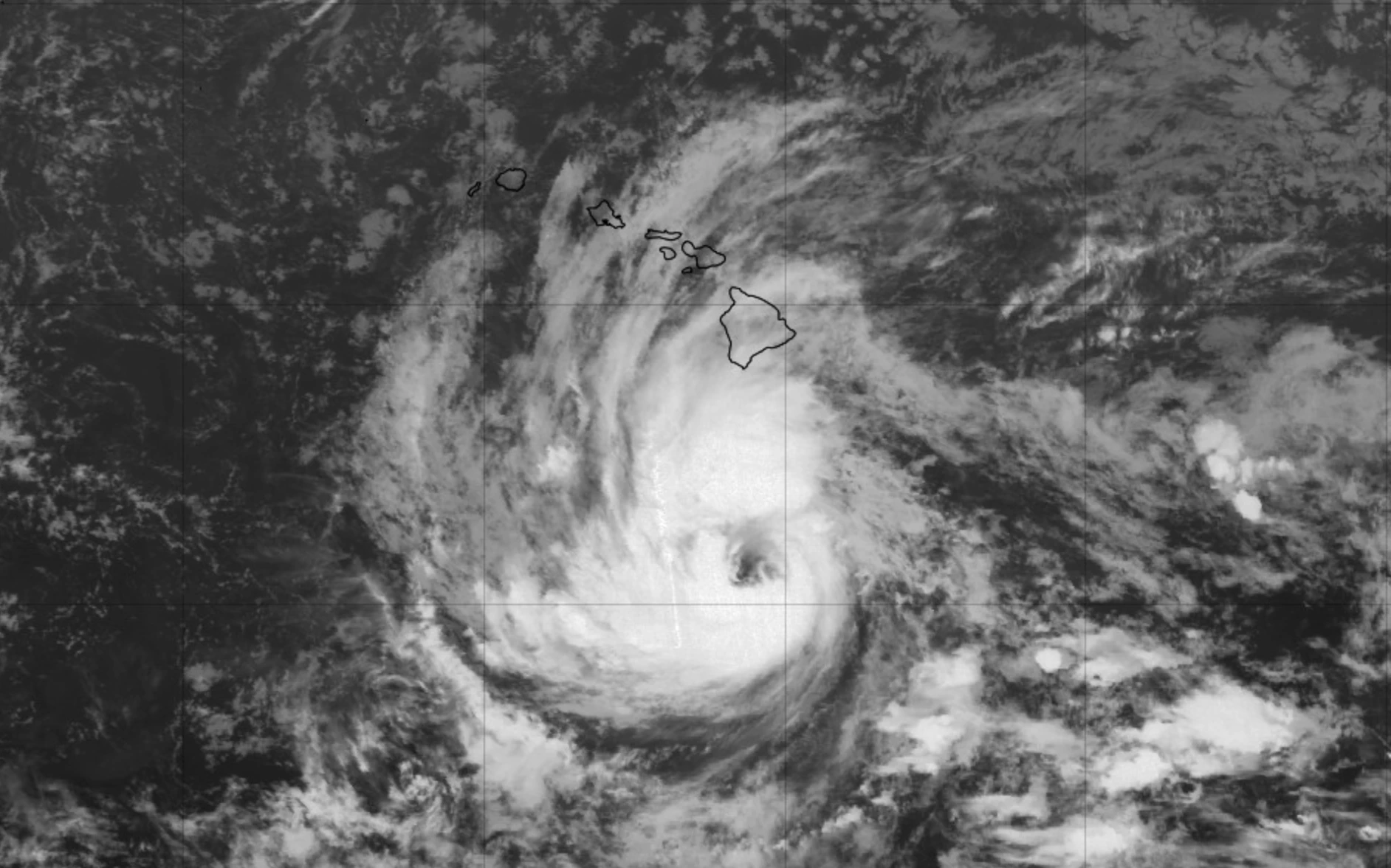
Hurricane Lowell turns toward Hawaii early next week. A Category 3 with 125 mph winds about 600 miles south of Lihue Friday morning, Lowell is forecast to restrengthen and make its closest approach to the westernmost islands late Monday and Monday night, with CPHC saying watches are likely for part of the state on Saturday. Governor Green signed a statewide emergency proclamation September 3 that activates the National Guard and lifts the $10 million cap on the state Major Disaster Fund.
A long-duration heat wave settles over the Mississippi Valley and southern Plains September 6 through 10. WPC expects widespread Extreme HeatRisk, driven in the south-central Plains primarily by overnight lows that stay very warm, with heat indices above 105 degrees across the Southern Plains and Lower Mississippi Valley. No watches or warnings have been issued for that window yet.
Hurricane Marie sends dangerous surf into Southern California this weekend. NWS San Diego has a High Surf Advisory and Coastal Flood Advisory running 6 a.m. Saturday through 11 p.m. Tuesday for 6 to 10 foot sets on south and southwest facing beaches, and NWS Los Angeles has a High Surf Advisory of 5 to 8 feet covering Ventura County, the Malibu coast, Los Angeles County beaches and the Channel Islands. Minor coastal flooding is expected near high tide.
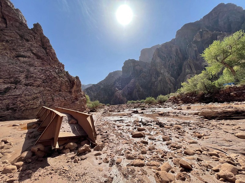
Bright Angel Canyon Flood. Source: Grand Canyon National Park / NPS
Disasters in the Headlines
Inside the failed mission to eliminate FEMA
FEMA is off the chopping block. But disaster aid is still a guessing game.
California Lawmakers Adjourn Without Voting on Wildfire Bill
Oregon's 2026 wildfire season brings record costs
Blackout Risk Rises as Heat Wave Stresses Largest US Electric Grids
PRO PERSPECTIVE
What would you ask a satellite?

Josh Barnes has a line he saves for parties. When someone asks what he does, the Manager of the Disasters Response Coordination System at NASA Langley Research Center gives the short answer, then adds: "I love my job. When there's a major disaster anywhere in the world, we can call up the astronauts on the International Space Station and they will take pictures for us." It's true, and it's the easy half of the job. The satellites are already up there. The hard part is making sure what data comes down from orbit lands in an emergency operations center as the answer to a question someone asked.
One email, three questions
Before June 2024, NASA disaster support often ran on relationships. An emergency manager would meet someone from the NASA Disasters Program at a conference and file the name away in case they ever needed it: "I know this guy at NASA." But one person can only see a fraction of what the agency offers.
The Disasters Response Coordination System, launched in June 2024, replaced the ad hoc model with a front door - with the goal to carry the best available science “the last mile” to those who can put it to work. Any disaster response organization (state, local, tribal, territorial, federal, or NGO) can email drcs@nasa.gov. Intake turns on three questions: what geography you care about, what you need to know, and when you need it. If no satellite will pass over the area in the window or other agencies are better suited to support, NASA says so and points the requester elsewhere. When timeline, question, and capacity line up, the program stands up an event team, taps experts across NASA's centers, and publishes data products to an open-access mapping portal.
The what, the so what, and the now what
That front door also controls what flows back out. Requesters facing the worst flood or fire in their county's history sometimes ask NASA for everything it has. Barnes could comply; the program has more than 150 data products. Most would bury a state EOC without helping it. "There needs to be a demand signal for the data that we're publishing," he says.
His team sorts its work into three buckets. The "what" is situational awareness: size, scope, and scale, fast. The data is most impactful when the emergency manager is looking to understand the size, scope, and scale of a disaster over areas too large, too remote, or too difficult to access. The "so what" is change detection, comparing conditions before and after an incident. "It's not modeled data, it's all observed," Barnes says, and it matters most at the edges of a disaster. A quiet area on the periphery may be fine, or it may be unable to call out; observed change shows where to look. The "now what" layers that change over population and infrastructure, which is where a map becomes a decision. During Hurricanes Helene and Milton, DRCS nighttime lights products estimated power loss down to the ZIP code, and FEMA shared them on its incident resources page.
Barnes, who holds a Master of Public Health and led healthcare system recovery at HHS, sees the "now what" bucket as the biggest opening. Correlate granular outage data with populations dependent on powered medical equipment and oxygen, and you know where generators and cooling centers should go first in an extended outage. Finding those residents across an entire county or state, he says, is "an untenable challenge without good data." The same logic traveled abroad: after an earthquake in Venezuela, data his team derived became some of the first information urban search and rescue crews had on their phones, showing where to start searching a debris field.
The return signal
Ground truth flows the other way, and Barnes wants more. Astronauts photographed storm tracks by hand in 2024, and in 2025 the NASA Response Mappers pilot began collecting land cover photos from the public through the GLOBE Observer app. From 250 miles up, a signal is an interpretation based on the bounds of spatial resolution and environmental conditions. The satellite observation gives a data-driven reason to more efficiently direct ground crews and collect confirmation and see what has happened. Each confirmation builds confidence in the interpretation and continues to refine how we leverage the science to make the next product.
The harder gap is capacity. At conferences, emergency managers tell Barnes the data sounds valuable, then level with him: "I've got half a GIS person. I share them with the public works department. I have no idea how I'm going to be able to actually make good use of the stuff that you're offering." Even capable organizations, mid-disaster, ask for a level of finish a science agency is not built to guess at. One told him: "Whatever you would give to your chief executive, that's the level of refined data that I need right now, because I have neither the time nor the bandwidth to do the further analysis."
That request frames his five-year picture: automation and AI to free scientists' time and make products faster and more consistent. Speed only pays off if the receiving end can absorb it, so the bridge gets built from both directions: an emergency management community equipped to ingest and integrate the data, and a NASA that keeps getting better at delivering it. "That's where I want to be," Barnes says. "That's where I think the magic happens."
Active Federal Declared Disasters and Deadlines
There is usually a 60 day window to apply for help after a disaster is declared. The following disasters are actively taking applications from survivors for financial support. To apply, survivors can visit DisasterAssistance.gov or call the FEMA Helpline at 1-800‑621‑3362.
Louisiana - Tropical Storm ArthurSTATUS Major Disaster declared June 30, 2026; IA applications accepted in eligible counties until October 1, 2026 AFFECTED COUNTIES Avoyelles, St. Landry, St. Tammany, Terrebonne |
West Virginia - Severe Storm, Straight-line Winds, Tornadoes, Flooding, Landslides, and MudslidesSTATUS Major Disaster declared August 3, 2026; IA applications accepted in eligible counties until October 3, 2026 AFFECTED COUNTIES Lewis, Upshur |
Northern Mariana Islands - Super Typhoon BaviSTATUS Major Disaster declared August 3, 2026; IA applications accepted in eligible counties until October 3, 2026 AFFECTED COUNTIES Rota (Municipality) |
Mississippi - Tropical Storm ArthurSTATUS Major Disaster declared August 3, 2026; IA applications accepted in eligible counties until October 3, 2026 AFFECTED COUNTIES Hancock, Harrison, Pearl River, Stone |
Indiana - Severe Storm, Straight-line Winds, Tornadoes, and FloodingSTATUS Major Disaster declared August 25, 2026; IA applications accepted in eligible counties until October 25, 2026 AFFECTED COUNTIES Hancock, Harrison, Pearl River, Stone |
Hawaii – Kona EarthquakeSTATUS AFFECTED COUNTIES Hawaii |
Oglala Sioux Tribe – Severe Storms, Straight-line Winds and FloodingSTATUS Declared September 1, 2026. Individual Assistance available across the Pine Ridge Reservation. No application deadline has been published yet; check DisasterAssistance.gov. |
Sign up for This Week in Disasters here.