Are you a disaster survivor looking for help? Click here
This Week in Disasters
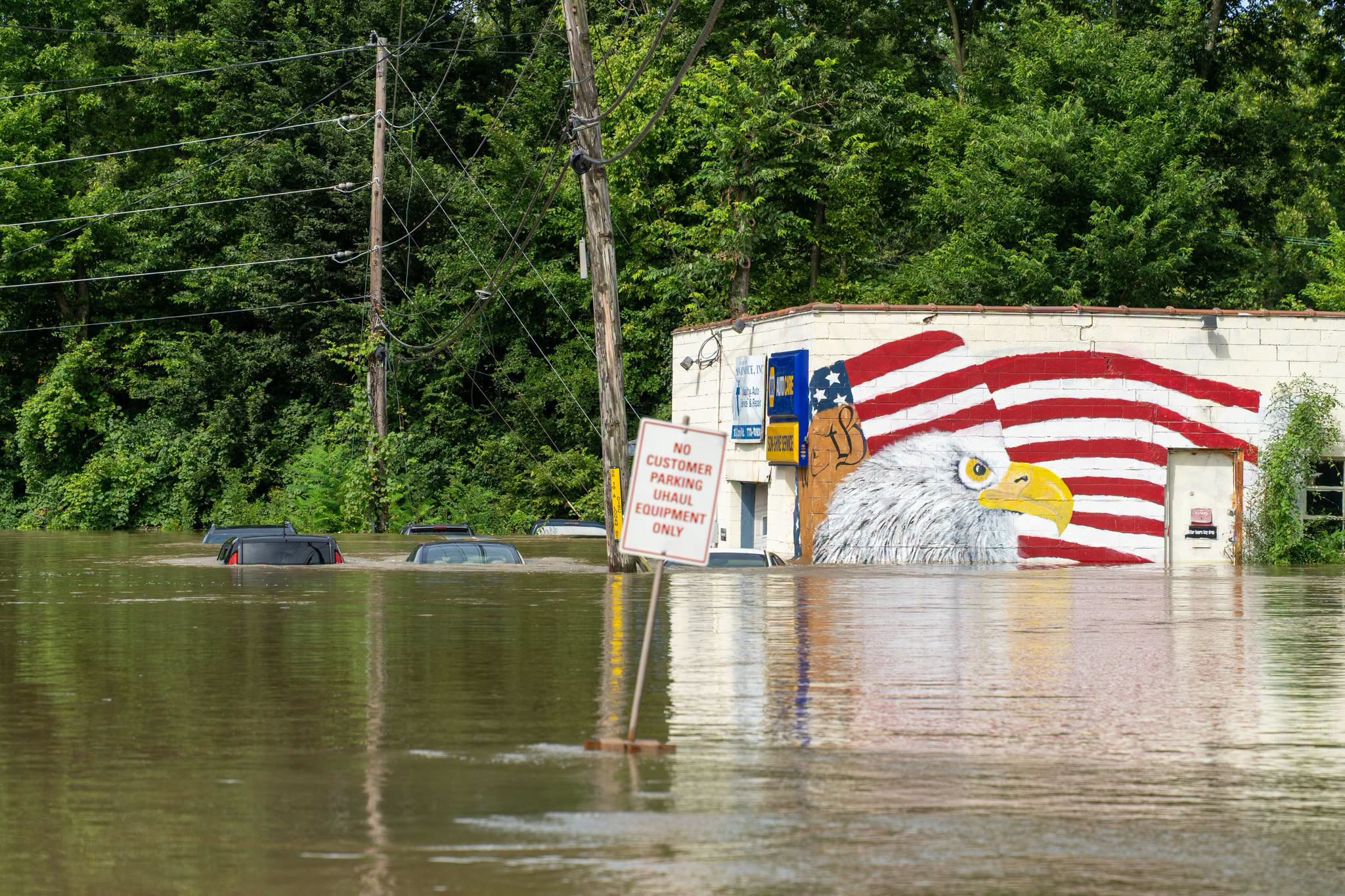
Source: Flooding in Indiana. Source: Indiana Department of Homeland Security
Plus, a destructive tornado draws thousands of cameras. How can we make recovery of a disaster do the same?
Welcome back to This Week in Disasters! This newsletter combines expert perspectives with a weekly roundup of upcoming threats, recent natural disasters, and available survivor assistance. If you’re a Risk, Insurance, Employee Assistance, NGO or Emergency Management professional (or you’re just really curious about disasters in the United States!) you’re in the right place.
Major Disasters of the Last Week
Hurricane Lala landed on the Big Island on August 16 as a Category 1 storm, damaging or destroying more than 100 homes. More than 40 inches of rain fell across parts of the state, power went out for tens of thousands of customers, and Governor Josh Green declared a state of emergency and activated over 200 National Guard members. Read more. |
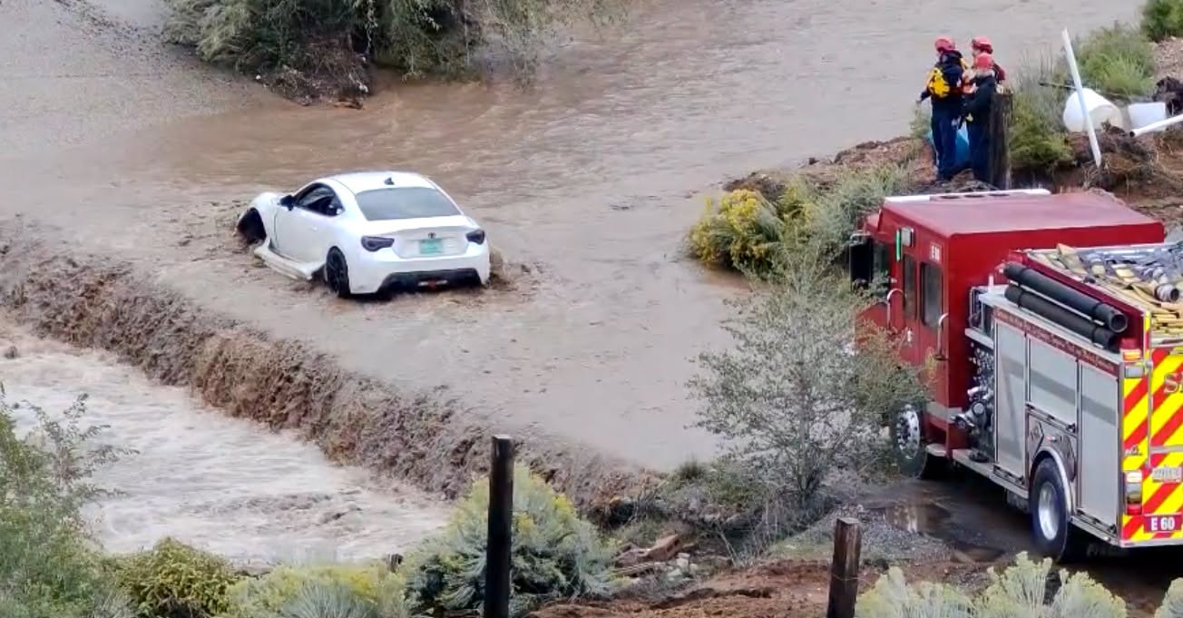
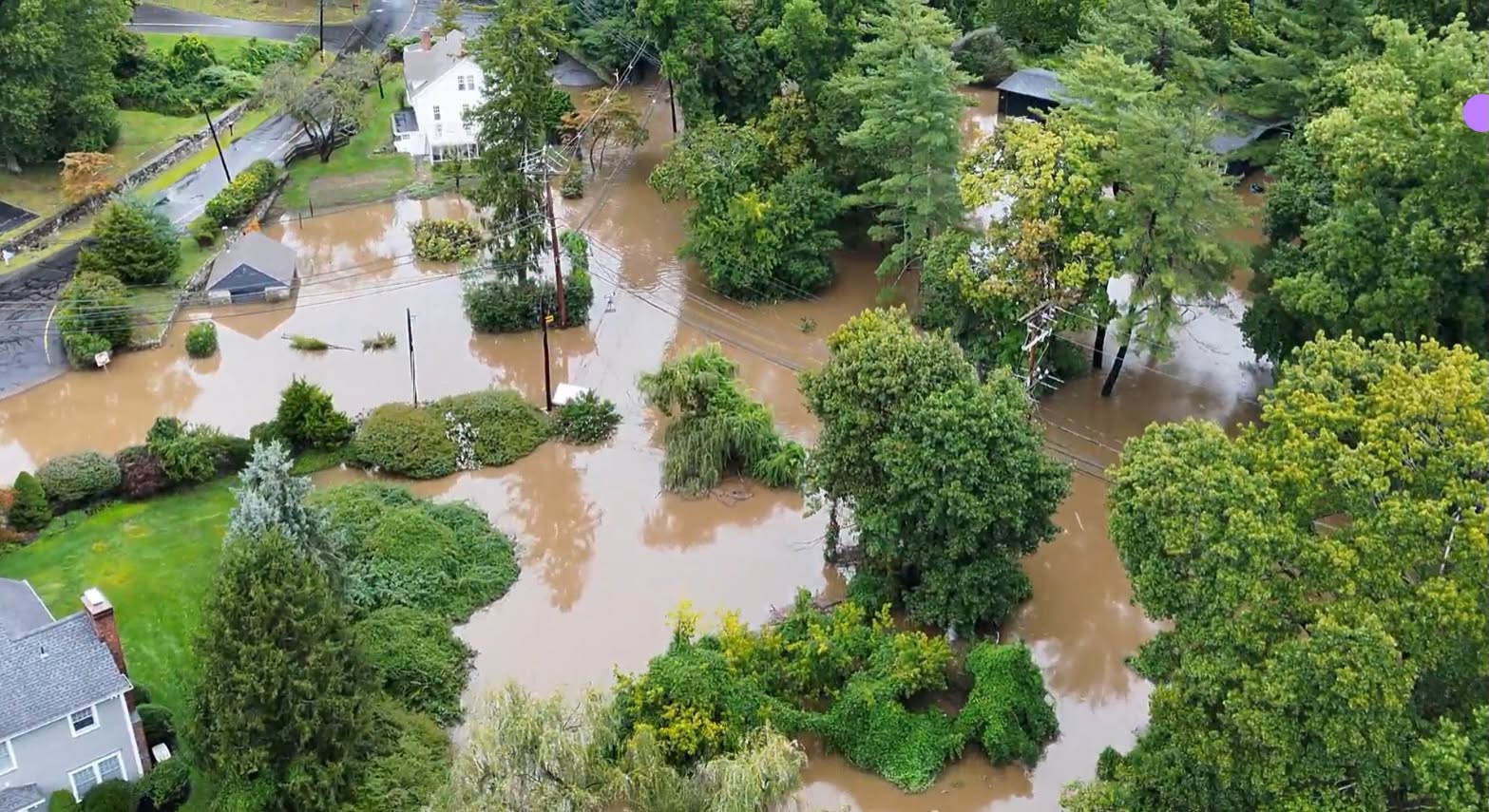
The White River crested at 24.6 feet on August 15, its highest level on record and the peak of days of flooding that Indianapolis officials called the worst in more than 30 years. New Castle and Springport recorded more than a foot of rain and roughly 150,000 customers lost power at the peak. Read more. |
The Pacific Northwest remained the nation's busiest wildfire region, with roughly three dozen large fires burning across Washington and Oregon. Named fires including Washington's Little Giant and Oregon's Grasshopper, Hagen, and Wrights Spring threatened homes, forcing evacuations in several areas this week. Read more. |
Forecasted Risks for Next Week
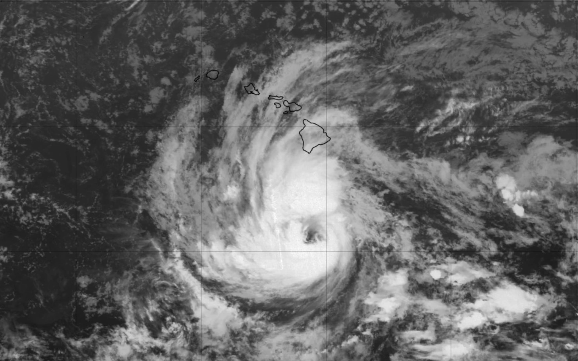
Tropical Depression Two-C forecast to strengthen into Tropical Storm Moke, could bring heavy rain to Hawaii this weekend. It is expected to pass just south of the islands with its closest approach to the Big Island on Sunday. Forecasters warn of 5 to 15 inches of rain there and a risk of life-threatening flooding and mudslides, especially over the areas Lala just hit.
Severe thunderstorms are possible across the northern Plains and Upper Mississippi Valley on Monday. A front moving through the area could bring damaging wind and large hail into Tuesday.
Monsoon thunderstorms could bring localized flash flooding to the Desert Southwest. Tropical moisture is expected to fuel scattered storms across the Southwest, Southern Rockies, and West Texas through Tuesday, with the sharpest risk over recent burn scars.
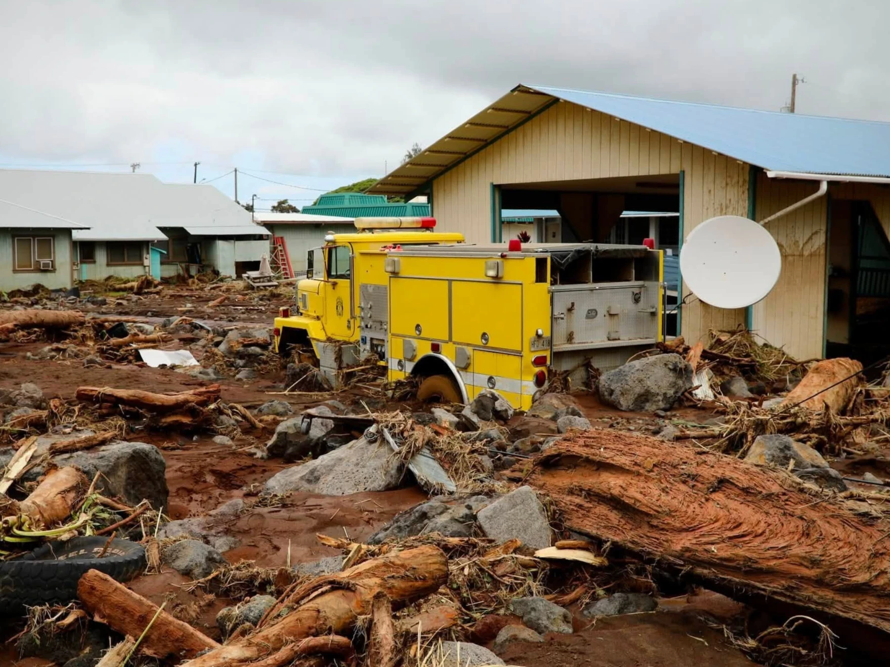
The aftermath of Hurricane Lala. Source: Hawaii National Guard
Disasters in the Headlines
Virginia launches statewide emergency readiness framework
Indiana residents frustrated amid 10-day power outage following storms
The Role of Insurance in Funding and Financing Resilience
PRO PERSPECTIVE
Storm Warnings Went Social. Recovery Information Never Did.
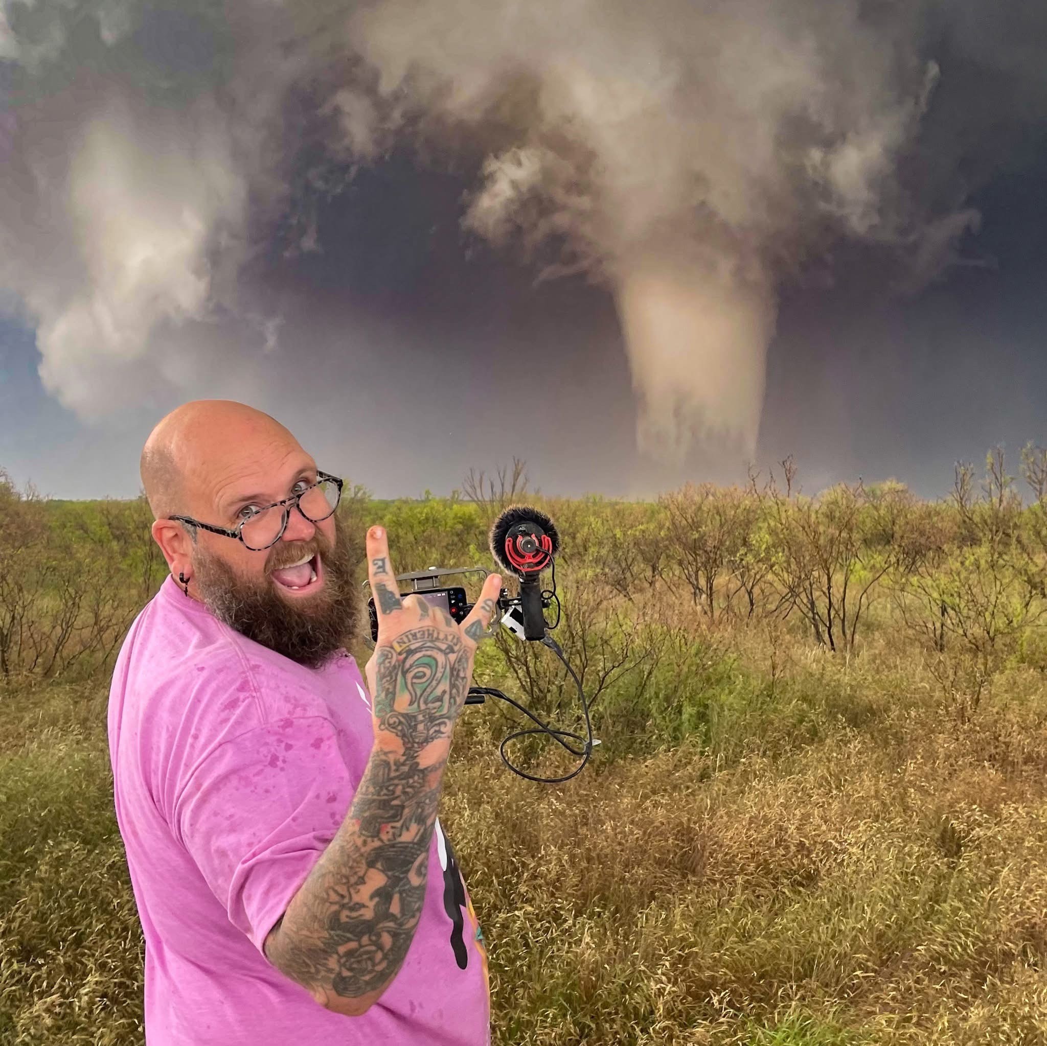
May 31, 2013. Edgar O’Neal had lived in Oklahoma City for a few months when the El Reno tornado tracked toward his neighborhood. At 2.6 miles wide, it remains the widest ever recorded. His only source was the TV. "The news told a whole city, 'if you don't have a storm shelter, get in your car and drive south,'" he says. It caused instant gridlock. He sat in dead-stop traffic with his wife and kids, hail hitting the car, unable to tell whether he was inside the tornado or outside it. The radio offered a looped National Weather Service bulletin that never told him where the storm was in relation to him.
That night defines his career: the data existed, the expertise existed, and none of it reached the person who needed it. He has spent the twelve years since closing that gap, one segment of the disaster timeline at a time.
Building the front end of the disaster ecosystem
O’Neal was a social worker for the State of Oklahoma when he asked around for a storm chaser who would let him ride along in the passenger seat and watch the job up close. One chase hooked him. He kept riding with an experienced chaser for two years before going out alone, took forecasting classes at the Storm Prediction Center in Norman, and became a full time storm chaser in 2020 after a TikTok livestream from Lubbock, Texas drew 40,000 viewers. What he noticed in that stream shaped everything after: viewers were not just spectating. They were asking whether the storm was coming toward their town. So he started calling out cross streets.
That ground-level reporting now feeds a formal channel. Chasers file ground reports to the National Weather Service through an app, and forecasters use those reports to issue or upgrade warnings. "Sometimes radar doesn't paint the clearest picture of what's actually happening on the ground," O’Neal says. "You can't rely on it a hundred percent." In Westmoreland, Kansas in 2024, he watched a tornado approach a town with no sirens sounding. A police officer pulled up and told him there was no warning out yet. "There doesn't need to be one," O’Neal told him. "There's a tornado." The sirens followed. Weeks ago in Kentucky, a 911 director used his livestream of a rain-wrapped tornado to warn her city, then messaged him: "You were the only storm chaser on that. We didn't know that it was happening."
He pairs that reach with discipline. Unverified viewer reports never get repeated on his streams without a radar check or a second source, and anything unconfirmed gets labeled that way on air. In a life-or-death broadcast, he treats misinformation as an operational hazard, not a PR problem.
Turning to the back end of the disaster ecosystem
The warning side of the chain now moves at livestream speed. The recovery side does not, and O’Neal is blunt about it: nobody is communicating recovery information well right now, including traditional media. The chase gets thousands of cameras. The FEMA application gets none.
His new project with the Carnegie Endowment attacks that gap directly. The partnership exists because each side holds something the other lacks, and O’Neal puts it plainly: "This one group of people has an audience and they're good at explaining it. These people have the data. Let's put it together." The Carnegie team started by teaching him how disaster money actually moves, from FEMA and HUD appropriations down to a survivor's application. "I kept having to ask them to explain it again," he says. "I'm like, why is this so hard and difficult?" That confusion is the product. The content, built for his YouTube channel, follows him working through the system the way a survivor would, asking where the breakdown is.
The stakes show up on every return trip through Tornado Alley. Tornadoes hit the same regions again and again, which means chasers pass back through the towns they once warned and see whether recovery actually happened. Too often it hasn't. "It's sad to be somewhere three years later and it still looks like the tornado happened three years ago," he says. That is the question driving his content: where is the breakdown? Everyone he has asked in Washington, from senators' offices to past and current FEMA administrators, wants to fix it. The unsolved part, he says, is how.
The build he wants
Asked what structural change in disaster communication matters most in the next five years, O’Neal names one thing: "a circle of communication between the National Weather Service, the storm chasing community, and the disaster recovery community." All three, he says, work in silos. That last connection is the one with untapped value. A chaser holds a community's full attention at the exact moment before its recovery begins, then the storm passes and that audience disperses with it. Connect the three communities, and the chaser who livestreamed the tornado can direct those same viewers to FEMA applications, aid programs, and local recovery resources the next morning, and guide them through the steps once they get there in an engaging way. Chasers feed ground reports to the NWS through the app. The Carnegie project ties a chaser into the recovery world. But both run on individual initiative and personal relationships, and O’Neal wants a system that outlasts any one chaser. He has started walking into senators' offices to push for one.
"It's not gonna happen overnight," he says. "But we gotta start trying." In 2013, the warning never reached him. He has spent every season since making sure it reaches everyone else. Recovery is next.
Active Federal Declared Disasters and Deadlines
There is usually a 60 day window to apply for help after a disaster is declared. The following disasters are actively taking applications from survivors for financial support. To apply, survivors can visit DisasterAssistance.gov or call the FEMA Helpline at 1-800‑621‑3362.
Mississippi - Severe Storms, Straight-line Winds, Tornadoes, and FloodingSTATUS Major Disaster declared June 30, 2026; IA applications accepted in eligible counties until August 31, 2026 AFFECTED COUNTIES Franklin, Lawrence, Lincoln, Wilkinson |
Wisconsin - Severe Storms, Tornadoes, and FloodingSTATUS Major Disaster declared June 30, 2026; IA applications accepted in eligible counties until August 31, 2026 AFFECTED COUNTIES Bayfield, Brown, Buffalo, Jackson, Jefferson, Juneau, Kenosha, Manitowoc, Marathon, Milwaukee, Outagamie, Oneida Nation, Racine, Rock, Sauk, Vernon, Washington, Waukesha, Waupaca, Winnebago |
Michigan - Severe Storms, Tornadoes, and FloodingSTATUS Major Disaster declared June 30, 2026; IA applications accepted in eligible counties until August 31, 2026 AFFECTED COUNTIES Alcona, Allegan, Alpena, Antrim, Barry, Benzie, Charlevoix, Cheboygan, Crawford, Emmet, Grand Traverse, Gratiot, Iosco, Kalamazoo, Kalkaska, Manistee, Mecosta, Montcalm, Muskegon, Newaygo, Oceana, Osceola, Presque Isle, Roscommon, Saginaw, Washtenaw, Wexford |
Fort Peck Tribe - Severe Winter Storm and Straightline WindsSTATUS Major Disaster declared May 29, 2026; IA applications accepted in eligible counties until August 31, 2026 AFFECTED COUNTIES Fort Peck Indian Reservation |
Crow Tribe of Montana - Severe Winter Storm and Straightline WindsSTATUS Major Disaster declared May 29, 2026; IA applications accepted in eligible counties until August 31, 2026 AFFECTED COUNTIES Crow Indian Reservation |
Louisiana - Tropical Storm ArthurSTATUS Major Disaster declared June 30, 2026; IA applications accepted in eligible counties until October 1, 2026 AFFECTED COUNTIES Avoyelles, St. Landry, St. Tammany, Terrebonne |
West Virginia - Severe Storm, Straight-line Winds, Tornadoes, Flooding, Landslides, and MudslidesSTATUS Major Disaster declared August 3, 2026; IA applications accepted in eligible counties until October 3, 2026 AFFECTED COUNTIES Lewis, Upshur |
Northern Mariana Islands - Super Typhoon BaviSTATUS Major Disaster declared August 3, 2026; IA applications accepted in eligible counties until October 3, 2026 AFFECTED COUNTIES Rota (Municipality) |
Mississippi - Tropical Storm ArthurSTATUS Major Disaster declared August 3, 2026; IA applications accepted in eligible counties until October 3, 2026 AFFECTED COUNTIES Hancock, Harrison, Pearl River, Stone |
Sign up for This Week in Disasters here.